Rawalpindi (Pakistan,Panjab)
Culture
Rapidly developing into a large city, Rawalpindi has many good hotels, restaurants, clubs, museums and parks, of which the largest is the Ayub National Park. Rawalpindi forms the base camp for the tourists visiting the holiday resorts and hill stations of the Galiyat area, such as Murree, Nathia Gali, Ayubia, Rawlakot, Muzaffarabad, Bagh, Abbottabad, Swat, Kaghan, Gilgit, Hunza, Skardu and Chitral.
The city has two main roads: the Grand Trunk Road runs roughly from east to west and is known as The Mall as it passes through the cantonment. Murree Road originates toward north from The Mall, crosses the railway lines and brushes the east end of the old city on its way to Islamabad.
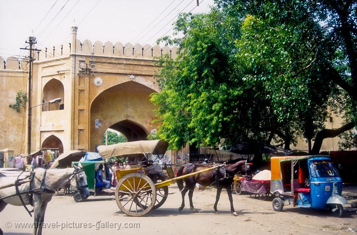
The two main bazaar areas are Raja Bazaar in the old city and Saddar Bazaar, which developed as the cantonment bazaar between the old city and The Mall. Another developing market is the Commercial Market in the area of Satellite Town near Islamabad.
The crowded alleys of the old city are home to many attractions, including Hindu (in ruins now), Zorastrian, Sikh temples and Islamic shrines. There are several museums and arts galleries such as the Lok Virsa, Pakistan Museum of Natural History, and the $Idara Saqafat e Pakistan.
Rawalpindi has been a military city since colonial times and remained Army headquarters after independence in 1947. Due to this, the city is home to the Pakistan Army Museum, with displays on colonial and present day armies, armoury of historical significance and war heroes.
Ayub National Park is located beyond the old Presidency on Jhelum Road. It covers an area of about 2,300 acres (930 ha) and has a playland, lake with boating facility, an aquarium and a garden-restaurant. Rawalpindi Public Park is on Murree Road near Shamsabad. The Park was opened to the public in 1991. It has a playland for children, grassy lawns, fountains and flower beds.
Rawalpindi (Urdu: راولپنڈی) Rāwalpindī) is a city in the Majha region of Punjab near Pakistan's capital city of Islamabad, in the province of Punjab. Rawalpindi is the fourth largest city in Pakistan after Karachi, Lahore and Faisalabad. Locally known as Pindi, the area was home to the pre-historic Soanian culture indigenous to this region. Numerous shopping bazaars, parks and a cosmopolitan population attract shoppers from all over Pakistan and abroad. In the 1950s, Rawalpindi was smaller than Hyderabad and Multan, but the building of Islamabad in the 1960s boosted the city's economy, resulting in a tenfold increase in population, from 180,000 to over 2.1 million.
Rawalpindi is also the military headquarters of the Pakistan Armed Forces and also served as the nation's capital whilst Islamabad was being constructed in the 1960s. The city is home to several industries and factories. Islamabad International Airport, formerly known as "Chaklala" airport, now known as "Benazir Bhutto International Airport" is actually in Rawalpindi; it serves the city along with the capital. Rawalpindi is located in the Punjab province, 275 km (171 miles) to the north-west of Lahore. It is the administrative seat of the Rawalpindi District. The total area of the city is approximately 154 square kilometres (59 sq mi). It is a bustling town strategically located between the Punjab and Azad Kashmir. Many tourists use the city as a stop before traveling towards the northern areas.


+-+c1890's.jpg)


History
Rawalpindi has been inhabitied for thousands of years, it is believed that a distinct culture flourished on this plateau as far in c1000BC. The material remains found at the site prove the existence of a Buddhist establishment contemporary to Taxila and of a Vedic civilisation. The nearby town of Taxila has another significance; according to the Guinness Book of World Records it has the world's oldest university - Takshashila University.
Sir Alexander Cunningham identified certain ruins on the site of the cantonment with the ancient city of Gajipur or Gajnipur, the capital of the Bhatti tribe in the ages preceding the Christian era. Graeco-Bactrian coins, together with ancient bricks, occur over an area of 500 ha (2 mi²). Known within historical times as Fatehpur Baori, Rawalpindi fell into decay during one of the Mongol invasions in the fourteenth century.
It appears that the ancient city went into oblivion as a result of the White Hun devastation. The first Muslim invader, Mahmud of Ghazni (979-1030), gave the ruined city to a Gakhar Chief, Kai Gohar. The town, however, being on an invasion route, could not prosper and remained deserted until Jhanda Khan, another Gakhar Chief, restored it and named it Rawalpindi after the village Rawal in 1493. Rawalpindi remained under the rule of the Gakkhars until Muqarrab Khan, the last Gakkhar ruler, was defeated by the Sikhs under Sardar Milka Singh in 1765. Singh invited traders from the neighbouring commercial centres of Jhelum and Shahpur to settle in the territory.
Early in the nineteenth century Rawalpindi became for a time the refuge of Shah Shuja, the exiled king of Afghanistan, and of his brother Shah Zaman. The present native infantry lines mark the site of a battle fought by the Gakhars under their famous chief Sultan Mukarrab Khan in the middle of the eighteenth century. Rawalpindi was taken by Sikh ruler Maharaja Ranjit Singh in 1818. It was at Rawalpindi, on March 14, 1849, that the Sikh army under Chattar Singh and Sher Singh finally laid down their arms after the battle of Gujrat and were decisively defeated.


No comments:
Post a Comment