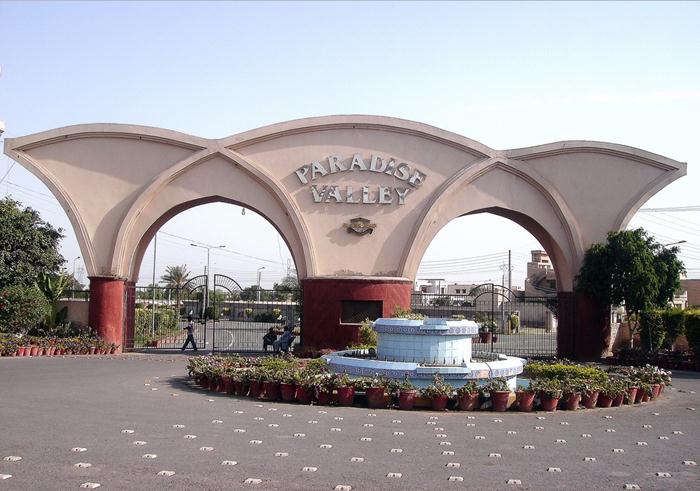
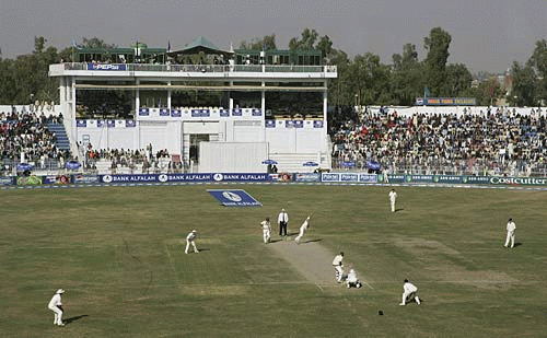
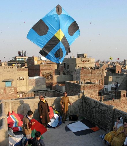
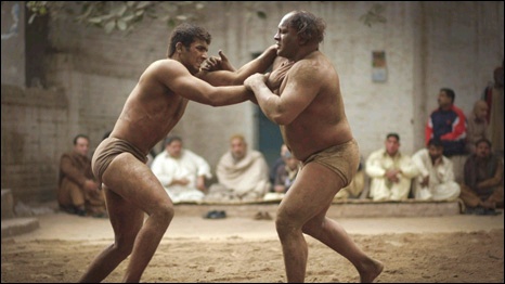
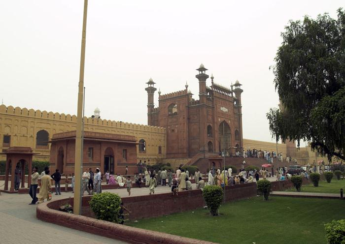
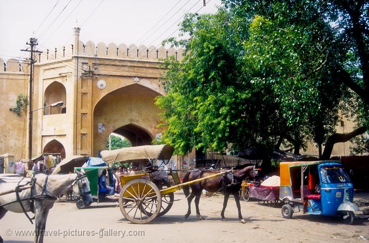
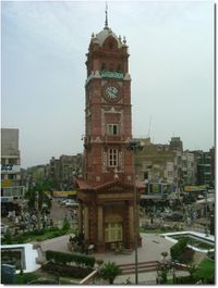
Saturday 19 January 2013

Sargodha (Pakistan , Panjab)


Sargodha
Sargodha has very rich agricultural land and a divisional headquarters. It includes khushab, mianwali, bhakar, and sargodhaitself. Aastan-i-Fazal, near 49 N.B (tail) is a best place to visit.Its a place in Sargodha where humanity is served in the way of ALLAH. tasuwuf, sufiezim and silsala-e-qadria.
Sargodha city is well developed city in terms of education and facilities. The literacy rate of sargodha city itself is very good. There are lot of good institution in sargodha e.g. "HIRA Poly Technical Institute" is the best institute of technology in Sargodha(informed by Nauman Bashir),army public college, Fazia model inter college, Punjab college, itm college,air base inter college and air base cadet college. The goverment college of sargodha now has been upgraded in sargodha university which offers number of undergraduate and postgraduate courses. Transportation in sargodha is much better than other nearest districts. The main entertainment in sargodha is cinemas and theatres. The main cinema of sargodha is Khayyam cinema which was first constructed by late Choudhary Zafar Ullah Khan in 1966 and is still owned by the same family.

Role of Sargodhians in 1965 Pakistan India War.

In 1966, Pakistan Government had awarded the citizens of Lahore, Sialkot And Sargodha for their braveness in the Indo-Pakistani War of 1965 which was started on 06.09.1965. when the Indian Army Troops suddenly attacked and break the Line of Control in the West Pakistan sector at near about 3.00 AM. The Indian Army Chief and high official announced that they would take dinner in Lahore Gymkhana Club. BBC announced this news in their news bulletins again and again. But all there dreams changed in to a dreadful dream, false and baseless when they cannot able to cross the BRB Canal with their utmost try till the end of the war. During this 17 days war, the character of Lahoris proved themselves as an undefeatable through their bravery. 
On 07.09.1965, the Indian Army attacked with over 1,000 armed Sherman tanks at Sialkot sector but all their dreams has been changed in to a dreadful dreams when the brave men from Pakistan Army laid down to tie the bombs on their chests and laid down in front of these tanks. It is called that this tank war was the second biggest war of tanks after 2nd World War. In the result, all most all the tanks were changed in to scrap. On the very same day, the Indian Air Force attacked the biggest air attack over Sargodha Air base with their latest Russian Mig which the had taken from the Soviet Union. But by the grace of Almighty Allah (God) once again helped the Pakistanis and most of their Russian Mig were totally damaged or fell down in an air fight.   Seeing this braveness of the People of Lahore, Sialkot and Sargodha, the Government of Pakistan awarded the cities and citizens of Lahore, Sialkot and Sargodha with the flag name "HILAL-E-ISTAQLAL" which is one of the highest civilian award. 

The citizens of Lahore, Sialkot and Sargodha played an important role in this war and helped Pakistan Army and Pakistan Air Force and Pakistan Navy with their full zeal and zest.
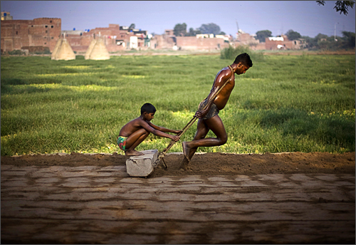
In the district of khushab most of its land is arid and is of two types, one is situated near a salt range, and the other one is thal.
In thal people cultivate gram( chana) on a large scale. Most people of khushab's thal rely on gram. Some land is occupied by saline water.
There are some lake type places where saline water is available throughout the whole year.and it is spoiling the land for years. Some of that palces are kaka, rangpur, and laghari.
Literacy rate in khushab is not low but not suffciant due to unavailability of schools and colleges. Most of the students travel daily for an hour or more to get in the college and same with high school.
Transportation is very poor.roads are damaged, specially muzafargarh road which leads to multan from jauharabad is not repaired and not modified for years.

Mianwali is the second district of the sargodha division and was developed in 1909.literacy rate is reasonable.

Bhakar is also desert area but it is developed and people use tubewells to water their land. But installing a tubewell is costly and a comman man can not afford it.literacy rate is reasonable.
But transportation facilties are not good. People are migrating towards well-off areas like jauharabad and other cities like sargodha.
Jhelum river runs between district khushab and sargodha.it also acts as a boundry line but is not more than a hindrance. People mostly have their relation across the river and crossing river is very teasing experiance.

Bridge is being demanded at jhelum river near jauhara kalan. Funds have been approved but no progress has yet been made.
Another problem that has made people' life uncertain is atomic energy plant atgiroot. it is causing environmental and aquatic pollution.

Plant is disposing off its wastes in river from chashma jhelujm link canal at sher garh
SAHIWL TOWN, is a very famous town and tehsil headquarter of sargodha disstt.

NEHANG is a beautiful town at sargodha jhang road 55 kilometers it is a big market for the people of rural areas here is the bigest grave of hazrat sakhi hayat almir 25 feet long at the top of a hill called punj peer which is almost 1000 years old....;Its also a big Grave yard its also called BHAHOOR.The town has very rich tallent of NAAT singing. The famous Naat khwan of TV and Radio SHAHZAD AKMAL SAIFI is also belongs that town. 
Farooka is also nearest town of sargodha and is directly linked with sargodha. its about 50Km from sargodha. most of the people work in big cities (ie karachi, lahore, islamabad, etc) and contribute in the development of the country. but basicly its an agriculture town producing weat, sugar cane, rice, oranges and many other.
chishtia sugar mills pvt limited is one of the biggest sugar mills of punjab contributing to resolve the sugar crisess in pakistan.


City of passionates:
In sargodha people enjoy life and all the good things that comes with a challenges...


Sialkot (Pakistan , Panjab)

Sialkot 


A city named “Sialkot” is situated in Pakistan’s province Punjab. It is placed near the border of Indo-Pak, about 125k.m. from Punjab capital Lahore. Sialkot is also famous for being Allama Iqbal’s birthplace.
According to myths, century’s old Raja Sul constructed sialkot city. After the death of Raja Sul, some five thousand years ago there is a mythology that dynasty continued for a few fifteen hundred years and after that was badly swamped and for about one thousand years it remained as one vast unpopulated region.
The popular faith is that sialkot was re-founded Vikramaditya of Ujjain in the reign by Raja Sálbán or Sáliváhan, who gave the  present name to the place and built the city and fort. It is thought that the city name means “Fort of Sia,” in ancient times Sia individually a particular caste founded the city.
Population and Area
Main Sialkot area population is about (0.5 Million) 500,000 (est. 2001). The district area is 2,067 sq. miles [5,354 sq km], widen from southeast Ravi’s valley to northwest Chenab River.


Places of Attraction
  1. Iqbal Manzal
    Allama Mohammad Iqbal, Pakistan’s National Poet birth place is Iqbal Manzal. In Kashmiri Mohala, it is located. In 1861, Grandfather Shaikh Rafiq of Iqbal’s buys, this house and they moved there from Mohala Khatikan. Because it resembles to Iqbal, Pakistan Government bought this historical house and set up it as a museum, now it is open for visitors.
  2. Imam Sahib Tomb
    An awfully well-known Sufi (pious man) named Imam Shaib had been passed in Sialkot. He was a firm believer and lover of Islam. He was extremely sensitive about poor peoples. Imam Sahib was one of the majority’s renowned sialkot saints. His services for humanity will always keep him alive to all peoples. For coming eras too, he is a leading role model.
  3. Cricket Stadium Jinnah
    There is also a cricket stadium in sialkot for city’s talented peoples. Numerous international matches were held in that stadium. This stadium is also famous as Jinnah park.
       Agriculture
The southern portion of sialkot is infertile because it is irrigated by Upper Chenab Canal, while a northern portion extremely fertile. Approximately nine-tenth areas are cultivable under crops.
Such as millet, corn (maize), sugarcane barley, wheat and rice are the chief crops.
Industry
Sialkot is Pakistan’s essential industrial city. Once it was famous as the manufacture centre of paper and damascened ware. Sialkot includes modern industries such as Surgical Instruments production, cotton and flour mill, Ready-made garments, Sporting goods, Embroidery, Leather goods and Musical Instruments. Almost all products manufactured in sialkot industries are exported to a world. A large number of things are especially produced to export all above the world.
The industrialists of sialkot have made a dry port in the city with the help of Punjab Government. Sialkot business community also funded for the construction of the international airport of the city.
A number of organizations deal among business matters. Sialkot Chamber of Commerce and Industry are one of the most important offices. It is situated at Paris Road, and now known as Chamber of Commerce Road (Shara-E-Aiwan-E-Tijarat).
Village Life, Sialkot Pakistan - Sialkot, Punjab
Sailkot Has Any Types Sport Comodity
Is Called Sports City.......

Thursday 17 January 2013

Islamabad (Pakistan,Panjab)


 Islamabad


History:

Islamabad Capital Territory, located on the Pothohar Plateau, is regarded to be one of the earliest sites of human settlement in Asia. Some of the earliest Stone Age artifacts in the world have been found on the plateau, dating from 500,000 to 100,000 years ago. The crude stones recovered from the terraces of the Soan River testify to the endeavours of early man in the inter-glacial period. Items of pottery and utensils dating back to prehistory have been found.

Excavations have revealed evidence of a prehistoric culture. Relics and human skulls have been found dating back to 5000 BC that show this region was home to Neolithic people who settled on the banks of the Swaan River. The Neolithic people developed small communities in the region at around 3000 BC. A Buddhist town once existed in the region.

Situated at one end of the Indus Valley Civilization, the area was the first habitation of the Aryan community in Central Asia. Their civilization flourished here between the 23rd and 18th centuries BC. Many great armies such as those of Alexander the Great, Genghis Khan, Timur and Ahmad Shah Durrani used the corridor through Islamabad on their way to invade the Indian Subcontinent. Modern Islamabad is based on the old settlement known as Saidpur. The British took control of the region from the Sikhs in 1849 and built Asia’s largest cantonment in the region.

Culture:
This article relates to topics about the culture of Islamabad (Urdu: ثقافت اسلام آباد‎). Being the capital of the country, Islamabad has a modern culture that is at synch with other internationalised cities. It has a relatively recent history, being established as a planned city just 50 years ago. Islamabad has a reputation of being a thriving, business-minded capital that lies in the centre of Pakistan's growing urbanised scene. The white marble Faisal Mosque, which is an important landmark of the city one of the largest mosques in the world, is a central point of tourists as is the bustling Jinnah Market. The Islamabad Museum contains many relics and artifacts dating back to theGandhara period of the region, an intriguing fusion of Buddhist and Graeco-Roman styles.[1]
The living culture of Islamabad and Pakistan is best explored at Lok Virsa Museum, as well as the Institute of Folk and Traditional Heritage in Shakarparian Park.

Construction and Development:

When Pakistan gained Independence in 1947, Karachi was its first capital. In 1960, Islamabad was constructed as a forward capital for several reasons. Traditionally, development in Pakistan was focused on the colonial centre of Karachi, and President Ayub Khan wanted it to be equally distributed. Moreover, Karachi was located at one end of the country, making it vulnerable to attacks from the Arabian Sea. A capital which was easily accessible from all parts of the country was needed. The newly selected location of Islamabad was closer to army headquarters in Rawalpindi and the disputed territory of Kashmir in the North.

In 1958, a commission was constituted to select a suitable site for the national capital with particular emphasis on location, climate, logistics, and defence requirements along with other attributes. After extensive study, research, and a thorough review of potential sites, the commission recommended the area northeast of Rawalpindi. A Greek firm of architects, Konstantinos Apostolos Doxiadis, designed the master plan of the city which was based on a grid plan and triangular in shape, with its apex towards the Margalla Hills. The capital was not moved directly from Karachi to Islamabad; it was first shifted temporarily to Rawalpindi and then to Islamabad when the development was completed.

Parliment House

Supreme Court

islamabad city logo


grand hayat tower islamabad night view theme.jpg


Tuesday 8 January 2013

Rawalpindi (Pakistan,Panjab)

Rawalpindi  (Pakistan,Panjab)


Culture


Rapidly developing into a large city, Rawalpindi has many good hotels, restaurants, clubs, museums and parks, of which the largest is the Ayub National Park. Rawalpindi forms the base camp for the tourists visiting the holiday resorts and hill stations of the Galiyat area, such as Murree, Nathia Gali, Ayubia, Rawlakot, Muzaffarabad, Bagh, Abbottabad, Swat, Kaghan, Gilgit, Hunza, Skardu and Chitral.

The city has two main roads: the Grand Trunk Road runs roughly from east to west and is known as The Mall as it passes through the cantonment. Murree Road originates toward north from The Mall, crosses the railway lines and brushes the east end of the old city on its way to Islamabad.

The two main bazaar areas are Raja Bazaar in the old city and Saddar Bazaar, which developed as the cantonment bazaar between the old city and The Mall. Another developing market is the Commercial Market in the area of Satellite Town near Islamabad.

The crowded alleys of the old city are home to many attractions, including Hindu (in ruins now), Zorastrian, Sikh temples and Islamic shrines. There are several museums and arts galleries such as the Lok Virsa, Pakistan Museum of Natural History, and the $Idara Saqafat e Pakistan.

Rawalpindi has been a military city since colonial times and remained Army headquarters after independence in 1947. Due to this, the city is home to the Pakistan Army Museum, with displays on colonial and present day armies, armoury of historical significance and war heroes.

Ayub National Park is located beyond the old Presidency on Jhelum Road. It covers an area of about 2,300 acres (930 ha) and has a playland, lake with boating facility, an aquarium and a garden-restaurant. Rawalpindi Public Park is on Murree Road near Shamsabad. The Park was opened to the public in 1991. It has a playland for children, grassy lawns, fountains and flower beds.


Rawalpindi (Urdu: راولپنڈی) Rāwalpindī) is a city in the Majha region of Punjab near Pakistan's capital city of Islamabad, in the province of Punjab. Rawalpindi is the fourth largest city in Pakistan after Karachi, Lahore and Faisalabad. Locally known as Pindi, the area was home to the pre-historic Soanian culture indigenous to this region. Numerous shopping bazaars, parks and a cosmopolitan population attract shoppers from all over Pakistan and abroad. In the 1950s, Rawalpindi was smaller than Hyderabad and Multan, but the building of Islamabad in the 1960s boosted the city's economy, resulting in a tenfold increase in population, from 180,000 to over 2.1 million.

Rawalpindi is also the military headquarters of the Pakistan Armed Forces and also served as the nation's capital whilst Islamabad was being constructed in the 1960s. The city is home to several industries and factories. Islamabad International Airport, formerly known as "Chaklala" airport, now known as "Benazir Bhutto International Airport" is actually in Rawalpindi; it serves the city along with the capital. Rawalpindi is located in the Punjab province, 275 km (171 miles) to the north-west of Lahore. It is the administrative seat of the Rawalpindi District. The total area of the city is approximately 154 square kilometres (59 sq mi). It is a bustling town strategically located between the Punjab and Azad Kashmir. Many tourists use the city as a stop before traveling towards the northern areas.

Some Old Pics of Pindi -99445
Mussoorie+Church+1890's

History


Rawalpindi has been inhabitied for thousands of years, it is believed that a distinct culture flourished on this plateau as far in c1000BC. The material remains found at the site prove the existence of a Buddhist establishment contemporary to Taxila and of a Vedic civilisation. The nearby town of Taxila has another significance; according to the Guinness Book of World Records it has the world's oldest university - Takshashila University.
Sir Alexander Cunningham identified certain ruins on the site of the cantonment with the ancient city of Gajipur or Gajnipur, the capital of the Bhatti tribe in the ages preceding the Christian era. Graeco-Bactrian coins, together with ancient bricks, occur over an area of 500 ha (2 mi²). Known within historical times as Fatehpur Baori, Rawalpindi fell into decay during one of the Mongol invasions in the fourteenth century.

It appears that the ancient city went into oblivion as a result of the White Hun devastation. The first Muslim invader, Mahmud of Ghazni (979-1030), gave the ruined city to a Gakhar Chief, Kai Gohar. The town, however, being on an invasion route, could not prosper and remained deserted until Jhanda Khan, another Gakhar Chief, restored it and named it Rawalpindi after the village Rawal in 1493. Rawalpindi remained under the rule of the Gakkhars until Muqarrab Khan, the last Gakkhar ruler, was defeated by the Sikhs under Sardar Milka Singh in 1765. Singh invited traders from the neighbouring commercial centres of Jhelum and Shahpur to settle in the territory.

Early in the nineteenth century Rawalpindi became for a time the refuge of Shah Shuja, the exiled king of Afghanistan, and of his brother Shah Zaman. The present native infantry lines mark the site of a battle fought by the Gakhars under their famous chief Sultan Mukarrab Khan in the middle of the eighteenth century. Rawalpindi was taken by Sikh ruler Maharaja Ranjit Singh in 1818. It was at Rawalpindi, on March 14, 1849, that the Sikh army under Chattar Singh and Sher Singh finally laid down their arms after the battle of Gujrat and were decisively defeated.

Faisalabad (pakistan,Panjab)


Faisalabad (pakistan,Panjab)


Pre-independence


The city was founded by the British Lieutenant Governor of the Punjab, Sir Charles James Lyall for whom it was originally named Lyallpur. Prior to the British making the area into an urban center, it largely consisted of various villages. However, the construction of various canals allowed the area to be irrigated. After the founding of the city, people were invited to the city with promises of land if they were to work it. This allowed the city to grow rapidly.

The city of Lyallpur came into being in 1880. The city which is now well known as "Manchester of Pakistan" for its industrial activity, was nothing but a desolate tract of land 100 years ago. It did not rain here for weeks together and when it rained, the water vanished in the city land in no time. There was no village nearby. The city centre of Lyallpur was designed by Captain Poham Young, to imitate the Union Jack with eight roads radiating from a large clock tower in the centre to eight separate bazaars.

In 1895, the rail link between Wazirabad and Lyallpur was effected. The building of Railway Station wanted time, therefore, a Goods train wagon served at Lyallpur Railway Station (still present today). As the progress of colonisation stepped up Lyallpur was given the status of Tehsil of Jhang District and its administration carried on the tents on the old Theh (Mound) of Pucca Mari near Tariqabad. The Majestic Clock Tower of Lyallpur was constructed out of the funds raised by the Sikh Zamindars who collected it at a rate of Rs. 18 per square of land. The fund thus raised was handed over to the Municipal Committee which got it completed.

In 1902, the population of the town had exceeded 4,000. A considerable number of houses and shops to cater to the ordinary needs of the population had constructed. In 1903, decision to have an agricultural college was made. In the very next year, 1904, the new district of Lyallpur was constituted comparing of Tehsils of Lyallpur, Samundri and Toba Tek Singh with a subtehsil at Jaranwala which later turned into a full fledged Tehsil. In 1906, the District Headquarters began to function at Lyallpur and all the bazars and mohallas within the bounds of circular road were nearing completion and city began to spread outside the circular road. The Town Committee which has come into being in 1904, was upgraded as Municipal Committee in 1909 and Deputy Commissioner was declared to be the lst Chairman. In 1916, the grain market saw its shops surging with customers. In the same year the civil Hospital was expanded. With the advent of the World War II, the political awakening sprinkled its influence over the city. Revolutionary meetings were held. Fiery speeches were made. Slogans were written on the walls.

In 1943, Mohammed Ali Jinnah came to Lyallpur and addressed a gathering of over 2 million in Dhobi Ghat Grounds. When Pakistan was accepted as an independent unit, the Muslims of Lyallpur held special prayers and distributed sweets and food among the poor on March 3, 1947.

Post Independence


The city grew into a strong industrial and agricultural centre and on independence of Pakistan it was a major urban area. After independence, the city of Lyallpur marched rapidly on the path of progress. The city which had so far been known for its grain market, became a great commercial and industrial centre. The population of the city which in 1901 hardly touched the figure of a few thousands soared up to millions. Medical and educational level was lifted up. In 1977, the name of the city was changed to Faisalabad, after the name of the late king of Saudi Arabia, Shah Faisal-bin-Abdul Aziz. In 1985, the city was upgraded as a division with the districts of Faisalabad, Jhang and Toba Tek Singh.

Location

Faisalabad is situated 225-miles (360 kilometers) south of the Pakistan's Islamabad. The Faisalabad district lies from 30-35 to 31-47 north Latitudes and 72-73 to 73-40 east longitudes. Gujranwala And Sheikhupura districts bound it in the north. In the East by Sheikhupura and sahiwal districts. In the south By Sahiwal and Toba tek singh districts and jhang district is to its west.
The city covers an area of 5,856 Square kilometers. The city is linked to m-2 motorway (Islamabad-Lahore motorway) with m-3 motorway section (Pindi-Bhattian-Faisalabad motorway).
Faisalabad (Formerly Lyallpur) is a road and railway junction, which lies in an area watered by the Lower Chenab Canal. Cotton, wheat, vegetables, and fruits are grown there and the city is also an industrial centre with railway-repair yards, engineering works, and mills that process sugar, flour, and oil seed. Produce includes super phosphates, cotton and silk textiles, hosiery, dyes, agricultural equipment, and ghee (clarified butter). Faisalabad is the site of the University of Agriculture, founded in 1909.


Culture

Compared to its more tourist-attractive provincial capital, Lahore, Faisalabad is basically an industrial and agricultural city. It is the second largest business city in Punjab and it is a region for investment and economic prosperity. Textiles generate the best business in this city. There is a selection of sites and tourist attractions; however, even with such fast growth the country lacks historical significance since it was developed mostly in the last hundred years. The Faisalabad Clock Tower, locally called "Ghenta Ghar", was one of the first main market of Faisalabad and it is also the oldest area of the city. Here you can also find the remains of buildings which mainly belonged to the British Raj. This market has eight bazaars, forming a "Union Jack" (British flag), which can be seen from above. There are still structures from previous settlements such as Zoroastrian Temples, Buddhist Monasteries, Hindu mandirs and Sikh gurudwaras still visible, however, since the creation of Pakistan these have been converted into schools and museums. "D Ground" is the second most important market after Ghenta Ghar. The area has been continually developing into a shopping area with many brands from all over the world. It is seen at its busiest at night when local people come out for an outing. There are many local and western restaurants ranging from Namwah Chinese, Bundu Khan, KFC, Al Maida, McDonalds, Pizza Hut, Olive Garden, Sardines, Yummy 36, Cube and many open-air barbecues.
The Jinnah Garden is probably the most famous park in Faisalabad. It is locally known as "Company Baagh". The tomb of H.E. Sir Charles James Lyall is situated here. He was the founder of this city and the city was first named Lyallpur in his honour. There are many food outlets, walking paths and cycling lanes, and a huge fountain structure. The park is often used by the local council for holding rallies, concerts, shows and melas. Getwala Park is a small park situated on the edge of Faisalabad. It is popular for family picnics and relaxing. Canal Park is on the west bank of the Rakh Branch Canal. It is also a good place for families.
Happy Land Water Park is an amusement park built to international standards, a complete entertainment centre for families. It has the biggestwater slides in Pakistan. It is also equipped with swings for both children and adults. Getwala Swimming Pool is another water park which has a huge swimming pool, attracting many local Faisalabadis. Aqua Land Water Park, the latest water park to open in Faisalabad, stands on Canal Road and draws many expatriates and families. Sindbad is an amusement park located near the Iqbal Stadium that is used for national and international cricket matches. It has an indoor bumper cars, flume rides, train rides as well as large gaming arcade room to suit all ages.
Rex City is a huge computer shopping mall dealing with everything computer related. Here you can find a computer at low prices. There are service shops, as well as CD and mobile shops and computer software and hardware experts. There are also internet services from well known companies such as "Cyber net", "Wolnet", "dancom", "Nexlinx" and "Satcom" which provide high speed internet. Kohinoor One is a newly constructed shopping mall located on Jaranwala Road which has many retail outlets, restaurants, clothing outlets and home furniture stores. Am Tex Waterfall is to be found at Am Tex Squire, Abdullah Pur. Kaleem Shaheed Park is another famous Park in Faisalabad. It is Situated at Narrwala Road near Raza abad.
The majestic "Chenab Club" is a social club. It was the first such club established in Faisalabad. It still exists today and is used by the elite society of Faisalabad. It stands in the beautiful surroundings of "Jinnah Garden". The club is situated in the heart of the city, just a short walk from Railway Station and within walking distance of Clock Tower. There are also a few monuments still fully erect in many parts of Faisalabad such as Gumti Water Fountain, Qaisery Gate (Entrance to the Eight Bazaars), Ghenta Ghar and various Sikh Gurudwaras and Hindu Mandirs still visible in the older part of the city.
Faisalabadi cuisine is very much Punjabi cuisine. The samosas of Faisalabad are different from any others because here you can get the chatani variety. The very famous name Chacha Samosay Wala is also in the D Ground. Dahi Bhale is prepared by a Thele Wala at Jinnah Coloney, near Chatri Wala Ground. Gohl Gappay are basically made with flour into a ball shape and filled with black grams, onions, potatoes and other supplements. The most famous is a person who sells gole gappe on tehla in the start of the AminPur bazaar. A sour drink called "khatta" is served with them. Biryani & pulao (special cooked rice) are also very popular. Jehangir's Murgh Pulao is popular. English and continental foods are also easily available. There are also some Punjabi drinks like rabri, lassi, limo pani and sugar cane rusk.
Faisalabad Arts Council is situated near Iqbal Stadium. Arts council have a major role in promoting the cultural activities and the art in the city. It has an auditorium Ustad Nusrat Fateh Ali Khan Auditorium with a seating capacity of 500 people. Arts council organize many cultural events including exhibitions and cultural shows. The current Resident Director of Arts council is Ch Muhammad Asif Pervaiz, who has played an important role in the establishment and development of Faisalabad Arts Council.
Faisalabad has always been a hub of literature. Renowned poets and prose writers belong to this city. Sahir Ludhianwi, the great poet of the sub-continent, belongs to Faisalabad.
Faisalabad - District Government and  Courts
Faisalabad - Abdullahpur


Monday 7 January 2013

Lahore (Pakistan,Panjab)


Lahore (Pakistan,Panjab)


Some places carry the essence of human origin and the geniuses of human growth. Such places become significant for those who like to enjoy the nostalgia of old thoughts. The city of Lahore can truly be regarded as such a place. Having seen so many ups and downs of history and cultures, Lahore in itself is now a whole world carrying a multitude of the past and the willingness to excel in the future. From Rudyard Kipling to Abu-Rehan Al Bairooni, from Victorian era to Mughal era, from buildings and gardens to forts, the diversity of Lahore is some times unbearable, yet the bliss is eternal.


Dating the origin


It is quite difficult to judge the right date of origin and how the name Lahore was originated. There are different traditions carrying totally different origins and explanations. In the old writings we can find different shapes of the name of Lahore, of which some are listed:
L-hore            
    
Loha-war
Laha-wr             
Laha-nor
Laha-nahr
Laha-waar
Lo-hoor
La-hore

According to the Hindu mythology the city of Lahore is named after the son of prince Ram chandar whose name was “Loh” and who originated this city(James Taad 1883; Kanhya laal 1882; Sir Richard Temple 1884; Tahqeeq-e-Chisti 1867). There is also a tradition that it was name after “Lohaar chand” who was the nephew of prince Deep chand.
In the written history the oldest book in which we can find Lahore is “ Tareekh-ul-hind” by Abu-Rehan Al Bairooni, who traveled to India in the 11th century. In his book he remembers Lahore as an area not as a city whose capital was “Mandhor kor”. The famous Sufi saint of Lahore Hazrat Data Gunj Buksh who died in Lahore in 1088 A.D has also mentioned the city Lahore in his book “ Kashf-ul-Maajuub”. Abul -Farj who was a poet in the Ghaznavi period has written the name as “Loha-wr”. An Iranian scholar “Tahir Marozi” of 11th century in his book “Nazhat ul Mushtaq Fe Akhteraq ul Affaq”has mentioned Lahore as “ Laha-wr”. Ameer khusro in his masnavi “Quran ul Sadeen” has written the name as “Lao-hore” in 13th century when he portrays the attack of the Mughals.
According to Encyclopedia Britannica the famous Chinese traveler Yowang Chowang has mentioned the city Lahore as the great city of Bahamans.
The Greek geographer Batalemos (Ptolemy) of the second century has mentioned an area “Labokla”. In his maps he has referred a place Kasbeera (Kashmir), near river Badistan (Jehlum) and river Adres (Ravi). Here is a place called Labokla between Attock and Bahami bothra. Wilfred and Kingham both hold the theory of Labokla being the old name of Lahore (The comparative study of India by Wilfred, page 20; the Geography by Kingham, page 225-228). We can conclude the study by the following facts.
Lahore was called by different names in the ancient times. Religious history interprets Lahore as the city created by the son of Ram chandar. The old writings tell us about the origin of a definitive city in the 10th century. There were no Muslim dwellers before the 10th century. The city was of no historical significance before the attacks of Mahmood Ghaznavi in the 11th century. Lahore was of great significance in the Mughal era.

Major historical Events


The city has had a turbulent history. It was the capital of the Ghaznavid dynasty from 1163 to 1186. A Mongol army sacked Lahore in 1241. During the 14th century the Mongols repeatedly attacked the city until 1398, when it fell under the control of the Turkic conqueror Timur. In 1524 it was captured by the Mughal Babur's troops. This marked the beginning of Lahore's golden age under the Mughal dynasty, when the city was often the place of royal residence. It was greatly expanded during the reign of Shah Jahan (1628-58) but declined in importance during the reign of his successor, Aurangzeb.

From the death of Aurangzeb (1707), Lahore was subjected to a power struggle between Mughal rulers and Sikh insurrectionists. With the invasion of Nadir Shah in the mid-18th century, Lahore became an outpost of the Iranian empire. However, it soon was associated with the rise of the Sikhs, becoming once more the seat of a powerful government during the rule of Ranjit Singh (1799-1839). After Singh's death, the city rapidly declined, and it passed under British rule in 1849. When the Indian subcontinent received independence in 1947, Lahore became the capital of West Punjab province; in 1955 it was made the capital of the newly created West Pakistan province, which was reconstituted as Punjab province in 1970.

lahore museum

Culture"

Lahore has played an important role in Pakistani history. It was in this city that Pakistan's independence declaration was made. It was the largest city in the newly formed Pakistan at the time of independence and provided the easiest access to India, with its porous border near the Indian city of Amritsar only 30 miles (48 km) to the east. Large numbers of HindusSikhs, and Muslims lived closely in Lahore before the independence of Pakistan.
The city suffered revolts, demonstrations and bloodshed at the time of independence due to the enmity between Muslims and Hindus at the time and the uncertainty which loomed over the fate of Lahore even after India and Pakistan became independent. Lahore's culture, its history, institutions, food, clothing, films, music, fashion, and liberal community lifestyle attract people from all over the country.
The city has many significant connections with Sikhism and played an important part in the history of the Sikh GurusGuru Ram Das was born at Bazaar Chuna Mandi, Lahore in 1534 A.D. Guru Arjan Dev got the foundation stone of Harmandir Sahib, laid by a Muslim Saint Hazrat Mian Mir Ji of Lahore in December 1588. Guru Arjan met an untimely death when he was tortured on the orders of the Emperor Jahangir in 1606 in this city. The Gurdwara Dehra Sahib and the Samadhi (Mausoleum) of Ranjit Singh are located in Lahore.

Art and Architecture:

Art of Lahore has a strong bearing upon the Mughal period. The historical monuments and buildings of Lahore stand as the specimen of Mughal art and architecture. However, the heritage also has a touch of Aryans, Arabs, Persians, British, Sikhs and Greeks.
Lahore Fort, Badshahi Mosque, Shalimar Gardens, Nur Jehan's Tomb, Tomb of Jahangir, Anarkali Bazaar, The Lahore Museum,Chauburji or Char Minar and Bagh-e-Jinnah are some the major architectural works found in Lahore. The palaces/havelis, forts, madrassas and mosques make the Lahore art known among the rest of the world. The art galleries of Lahore also display a number of artefacts belonging to the Mughal period. Many contemporary artworks are also exhibited in the art galleries of the city.
In modern days, parts of Bahria Town Housing Scheme in Lahore are themed on ancient Egyptian culture. There are many other architectural notables, including themes for different locales that make Bahria a very interesting and well conceived scheme to visit and live in.
The World Performing Arts Festival is held every autumn (usually in November) at the Alhambra cultural complex, a large venue consisting of several theatres and amphitheatre. This ten-day festival consists of musicals, theatre, concerts, dance, solo, mime, and puppetry shows. The festival has an international character, with nearly 80 percent of the shows performed by international performers. On average 15–20 different shows are performed every day of the festival.
Lahore is also the centre of Pakistan's puppetry industry. Although not economically viable as a business, the Peerzada family has been arranging puppetry festivals for more than a decade, at one point even bringing the biggest festival in the world to Lahore.
Lahore's biggest contributor to the art scene is undoubtedly the National College of Arts, the country's, most prestigious art college, which has produced some of the country's most famous painters, writers, actors and musicians. There are also several art galleries throughout the city which hold exhibitions regularly among which the Drawing Room Art Gallery is the most popular.